How to Get There?
By subway:
The target station is “Créteil – Université”, on line 8.
-
From Charles-de-Gaulle airport: take the RER B going to “Robinson – Saint-Rémy-lès-Chevreuse” until station “Châtelet – Les Halles”, or
-
From Orly airport: take the RER B going to “Aéroport Charles-de-Gaulle – Mitry – Claye” until station “Châtelet – Les Halles”, then
-
take the subway line 1 going to “Château de Vincennes” until the station “Bastille”, and finally
-
take the subway line 8 going to “Créteil – Préfecture” until station “Créteil – Université”.
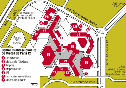
When you got there, take the pedestrian road on the right and the pedestrian bridge (see the map of Créteil below).
By car:
The university is accessible by car, with free parkings (outdoor and in the basement).
The address is 61 avenue du Général de Gaulle, 94010 Créteil.
The outdoor parking localisation is given by the following coordinates (N 48.7885255949435°, E 2.441960871219635°).
Maps:
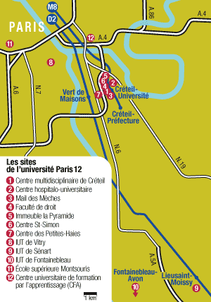
The map locating the university beside Paris:
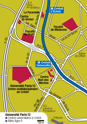
The map locating the university in Créteil:
The map of the university (to find building P2):